Followers

Tuesday, June 23, 2020

Formatting, Style, and General Changes

Hello! Sorry for not posting here as often as I should, but I think a great way to get the gears turning again with this blog is some formatting and general changes.

General Changes

I have noticed that this blog can be fairly limiting due to it having a more formal and informative nature. So I've decided that I'll post more about my travels, along with some more informative essay type articles. I also have got some better and more upgraded photography equipment, so this opens up the door for higher quality images that compliment the blog better.

Format Changes

Although the formatting seems to be working alright for this blog, I found that it's a little uneasy on the eyes due to the text being small and close together. Due to this, I changed up the font spacing a bit. I also am considering changing fonts, due to this font being not fully supported by the text editor.

Other than that, I expanded the blog page out a bit more to give it a more professional look.

Style Changes

I changed the background image to fit with the theme a little better. My Flikr account is now also linked in the sidebar, this is where I'll post a lot of the image I don't post here.

Monday, May 11, 2020

McKinny, Waynesburg, Kings Mountain KY

Location

If you take a wrong turn, you may just end up in one of these few tiny railroad towns scattered across the rolling hills of Kentucky. Beyond the straight and wide US 27 lies a few communities and towns lost to not only time, but lost to the rest of the world. These few places have interested me for a long while, and since they're so close together I decided to make a blog combining all three of these communities. Firstly, these towns have extensive history, which I will summarize. 

Geography

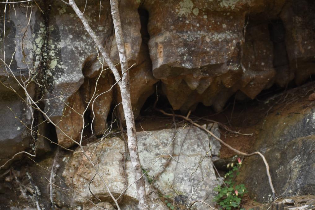
The geography of these areas are moderately hilly, with forests and farmland sprinkled in. Fishing Creek is one of the main creeks that runs through the area, along with Sims Branch. One thing you can notice from driving around is the amount of streams flowing out of the hills and rocks.

Kings Mountain

Kings Mountain is an unincorporated community in Lincoln County KY located along the Norfolk Southern Railway. This covers the history of Kings Mountain.

History

Kings Mountain's history begins in 1873 with the construction of the Kings Mountain Tunnel. This Tunnel was a large construction project that would allow trains to pass through the extensive valley of hills and knobs in the area. This project was not the very beginning of this area's history though. Due to the track only being one lane, a tower was built near South Fork to watch the trains carefully to prevent accidents. The area is believed to be named for the King family, who were one of the first settlers in the area. The area's postal name was "Kingsville", although this eventually changed into "Kings Mountain." The town eventually started booming into a bustling railroad town, and at one point had a hotel, although this information is unknown. 

According to local information, due to the tunnel length (9/10ths mile), many people suffocated inside the tunnel due to the fumes from the freight trains. Not only was the deaths enough to scare people off, the work environment was also fairly cruel. Elder J.G Livingston, a man who's history is vague, stated in the late 1800s that “Kings Mountain on the Southern Railway was decidedly the most ungodly and sin-cursed place in the country. At one time over 200 men were engaged in arching the great tunnel at that point. On Livingston’s way there he met a man who advised him to go back home, “You will be mistreated. They killed a man there last Sunday and whiskey flows up and down the streets.” 

Not only was Kings Mountain known for it's railroad tunnel, it was also known for it's various industries, including multiple blacksmith shops and at least two wood mills. The “Kings Mountain Echo” was a newspaper about the Kings Mountain area. It contained advertisements from the nearby areas of Waynesburg and Pleasant Point. 

There is some information about Kings Mountain at one time being an incorporated town. Town Hall meetings where supposedly held at the "Patterson Building". During this time, the Klu Klux Klan reportedly held public lynchings on top of the railroad tunnel, where multiple African Americans were killed. One incident taking place in Kings Mountain involved a resident throwing rocks at an African American man, then shooting him. This incident was investigated by the local Sheriff and the charges filed against the men are unknown.

As of today, Kings Mountain is full of abandoned buildings, and a really large railroad bridge on Tunnel Creek road, off KY 1778. 

Photo Gallery

Waynesburg
Waynesburg is an unincorporated community located south of Stanford. It is also located along the Norfolk Southern Railway. This covers the history 

History
Waynesburg's history dates back all the way to the early 1800s. In fact, the town was named after a Revolutionary Army General, "General Anthony Wayne." During the early days of the town, the mail was carried by the famous Pony Express. Eventually a mail route was established. The post office was reportedly moved a total of eight times. In 1907, the Waynesburg Deposit bank was built, and the building is still visible today, though in poor condition. Waynesburg was a town that was bustling with industry at one time, having a total of three factories: a canning factory, a mill, and a Delco Plant. 

Waynesburg also had a school, although I do not know the exact location, I do believe that it's on Pond School road. I was able to get several photos of the chimney that is still standing from the fallen school house. Around the time this school as built, the Civil War was ongoing still, and this is where Waynesburg civil war history and involvement shows. In November 1863, a stop by the Union Army in Waynesburg ended in 13 men being recruited to the 49th Regiment of the Kentucky Infantry. The 49th Regiment's role in the Civil War is very obscure, but there is evidence that they set up a camp in Burnside, a nearby city in Pulaski County. Despite the majority of major combat ending in the state, war was still raging in the bluegrass. Two of the 13 men rose above the rank of private during the war. All of the soldiers from Waynesburg survived the war.


Photo Gallery

McKinney
McKinney is a census designated place in Lincoln County KY, east of Hustonville. It has an extensive history dating back to the 1700s. This covers the history. It is a small town with a population estimated around 135.

History
McKinney's history is by far one of the most interesting I've heard about. McKinney's history starts way back in the days of the Cumberland Trace. McKinney was named "McKinney's Fort" during this time. As settlers made their way into Kentucky from the east, McKinney was one of the settling locations. During the expansion west, the natives were disturbed and attacked the settlers. Due to this attack from the natives, the settlers built forts, and one of those forts included McKinney. 

Archibald McKinney was the original founder of the town, he was granted land from his service in the revolutionary war, and this is where the history of McKinney begins. Originally McKinney's fort consisted of four log cabins, and a stockade. During this time, Logan's Fort (present day Stanford) was also ramping up their defense and colonization. Later on in the town's life span it became known as McKinney's Station, then eventually just McKinney as it is known today.

This is not where McKinney's history ends though. On a cold December night in 1966, a B58 plane crashed in a field near Short Pike Road, in between McKinney and Hustonville. The loud crash woke up many residents of the town. The B58 was the world's first super sonic bomber. It is believed that the pilot(s) of the aircraft perished in the crash. The plane likely came from Richmond, and was on a training flight. Oddly the historical marker for the crash site is listed on official KY history websites, but upon visiting the crash site I could not find it. 

Today, McKinney has a diner (The McKinney Depot) and an elementary school. It's Main Street is cracking and old, but it's masonic lodge is still standing, and potentially still in service.


Photo Gallery

Wednesday, April 15, 2020

Ritner KY

Location

Down a narrow gravel road in eastern Wayne County lies a small community nestled within the mountains of Appalachia. Ritner is a very unknown community that is overlooked by many, as it's not easy accessible to most, and is difficult to navigate. After traveling over half the state in the past year, I have never seen an area that beats the beauty of Ritner. It is one of the most unique, and alien like areas I have ever visited. It is a gift to the state of Kentucky that is criminally underrated and overlooked by many. If you haven't been to Ritner yet, it's worth the trip.

Geography

The geographic features in Ritner is a beauty that is overlooked by many travelers passing through the area. As you approach the area of Ritner, you'll start to notice limestone jutting out of the ground in grassy fields. Although this is common across Kentucky, it is more apparent here. This natural occurrence is called "karst geography". Karst is a word that refers to areas that are prone to sinkholes, caves, and underground springs. Here is a map from Chuck Sutherland showcasing the frequency in karst landscapes and caves in KY. As you can see, eastern Wayne County is fairly cave ridden and karst.

https://www.flickr.com/photos/chucksutherland/23901437858/in/photostream/


The closer you get to Ritner, the larger and larger the cliffs and mountains become. These mountains aren't your typical Kentucky foothills. These are massive, rocky cliffs that stand tall and tower over anything in it's reach. The most notable mountains and cliffs are Tabletop Cliff, Denny Cliff, Sand Cliff, and Moody Cliff. A very interesting feature I noticed was a massive boulder, about the size of an SUV balancing on top of a cliff. It was such an interesting find, and I'm surprised not many others have heard about this.

Not only is Ritner rich in it's limestone cliffs, it also has multiple creeks and rivers running through the area. The Little South Fork river intersects with Lick Creek in Ritner. The Little South Fork river is a tributary that begins around 5 miles west of Parker's Lake. Lick Creek has a noticeable turquoise tint to the water, likely due to the minerals from nearby caves.

Lastly, as I was taking photos of the cliffs in Ritner, I noticed that there was audible rushing water under the ground. near the side of the road. This was quite interesting, considering that underground streams typically aren't audible through the soil.


Notable Features

The Ritner Swinging Bridge is a small tourist attraction located in Ritner. As of now, it is closed to the public for repairs. The history of this bridge is obscure, but it is a gateway into the Daniel Boone National forest on the other side.

Photo Gallery

Ritner Balancing Rock

Denny Cliff
Stalagmites in a small cavern.
Ritner Swinging Bridge

Sources:

All Images Sourced from me.
topozone.com

Friday, March 13, 2020

Waco KY

Location


Among the rolling hills of Madison County lies some very unique and obscure places. Nestled on a small country road lies a small community named "Waco". Waco is slightly off of KY52, and continues onto KY 977. Despite being an unincorporated community, Waco is part of the Richmond - Berea Micropolitan Statistical Area.

Geography


A notable geographic feature is Muddy Creek, which lies roughly 3,000 feet from Waco. Muddy Creek is a small creek that begins on the Kentucky River and ends near KY 3376. The terrain around Waco is a mixture of plains and small wooded areas. Although, by looking at an overhead map, there appears to be an abnormal amount of ponds and bodies of water around the area.

History


The history of Waco is not only obscure, but it is interesting. Waco is believed to be named after Waco TX, although this is not confirmed. Some of the oldest industries in Madison county were started in Waco. This includes Waco Pottery Works. Waco is most known for it's deep history rooted in the art of pottery, as it generated a lot of revenue for the small community.

Griggs and Grinstead


The earliest pottery maker was John Parker Grinstead, and his brother Matthew D. Grinstead, who purchased land near Waco in 1837. Not only did Grinstead produce many works of pottery, he also indulged in the stone-working business. A lot of his work is still around, but is very scarce. Grinstead tended to brand his pottery and other works with "GRIGGS AND GRINSTEAD, WACO KY."


(https://www.mesdajournal.org/2012/research-note-nineteenth-century-stoneware-makers-madison-county-kentucky/)

Philip A. Huffman

Another notable figure in Waco KY's history is Philip A. Huffman. Philip Huffman was born in Bourbon County KY, and relocated to Madison County in 1847 where he purchased property adjacent to Grinstead's land. Huffman was successful in his business endeavors and employed several well known potters. One of the hired potters was Augustus H Serren, a potter born in New York or New Jersey. Huffman was known to mark his pottery with "P.A HUFFMAN." Later on, Philip hired multiple German potters and continued his pottery career.


Valentine Baumstark

Valentine Baumstark was another notable figure in Waco's history. He arrived in 1850, and married Mary Amerine the same year. Valentine was born in Germany and was likely trained in the art of pottery before he came to America. He was employed at Huffmans. He eventually became the foreman of the business.

Eventually, when Huffman departed to Texas, Baumstark started his own business on the eastern end of Waco. His business was reportedly destroyed by John Morgan due to him being a vocal Union sympathizer. Baumstark carried on and ran the business up until his death in 1885. John Baumstark, his son, carried on the business after his passing.


Businesses and Attractions

Despite being an unincorporated community, Waco has quite a few businesses and shops. The first noticeable businesses are the Shell gas station (also named "Waco Grocery") across the intersection of 977 and 52, and the People's Trust Bank across from the Shell. 

Down into the crossroads of Waco, there is a small Bakery named "Side Porch Cafe and Bakery" and a thrift store. On down the street there is the "Waco Animal Hospital". Waco also has a volunteer Fire Department across from the "Waco Church of Nazarene."

Lastly, the post office of Waco is still in service. 

Sunday, March 1, 2020

Falls Of Rough KY

Location


The gorgeous scenery at Falls Of Rough KY is taken for granted by travelers and drivers passing by on KY 79. If you blink you might just miss it.

Falls of Rough is a small unincorporated community on the border of Grayson and Breckenridge county. Located on the rough river, and with it's rich history there is a lot to explore in this small north west KY community.

History

In the late 1700s George Wilson from North Carolina, the first documented settler of the area arrived. He built the first dam along the Rough River. Later on, Benjamin Sebastian sold it Willis Green. Willis Green's house and store are still standing today. 

Originally when the first post office opened in 1830 it was named after Green, but later on was changed to "Falls Of Rough", named after the nearby river. The dam mentioned previously was washed out in 1855, then rebuilt by Lafe Green, who received 20k from B.F Beard to rebuild the dam. 

One of the notable features of the area is the old Grist Mill standing beside the rushing waters. Green owned lots of land in the area, and this mill was one of the many profitable businesses he was running. In fact, one of Green's mills produced over 6,000 barrels of flour a day.


Photos


Sources:


Tuesday, February 25, 2020

About this Blog

This is a project dedicated to exploring the niche, and hidden beauties of Kentucky. If you're into obscure history and traveling, you're on the right blog.

I'll try to update this blog at least once a week when I get the chance. Since spring is beginning to emerge early, I thought it would be a good time to open this up.

- Enrique
Hi, welcome to Exploring Kentucky.