Followers

Wednesday, April 15, 2020

Ritner KY

Location

Down a narrow gravel road in eastern Wayne County lies a small community nestled within the mountains of Appalachia. Ritner is a very unknown community that is overlooked by many, as it's not easy accessible to most, and is difficult to navigate. After traveling over half the state in the past year, I have never seen an area that beats the beauty of Ritner. It is one of the most unique, and alien like areas I have ever visited. It is a gift to the state of Kentucky that is criminally underrated and overlooked by many. If you haven't been to Ritner yet, it's worth the trip.

Geography

The geographic features in Ritner is a beauty that is overlooked by many travelers passing through the area. As you approach the area of Ritner, you'll start to notice limestone jutting out of the ground in grassy fields. Although this is common across Kentucky, it is more apparent here. This natural occurrence is called "karst geography". Karst is a word that refers to areas that are prone to sinkholes, caves, and underground springs. Here is a map from Chuck Sutherland showcasing the frequency in karst landscapes and caves in KY. As you can see, eastern Wayne County is fairly cave ridden and karst.

https://www.flickr.com/photos/chucksutherland/23901437858/in/photostream/


The closer you get to Ritner, the larger and larger the cliffs and mountains become. These mountains aren't your typical Kentucky foothills. These are massive, rocky cliffs that stand tall and tower over anything in it's reach. The most notable mountains and cliffs are Tabletop Cliff, Denny Cliff, Sand Cliff, and Moody Cliff. A very interesting feature I noticed was a massive boulder, about the size of an SUV balancing on top of a cliff. It was such an interesting find, and I'm surprised not many others have heard about this.

Not only is Ritner rich in it's limestone cliffs, it also has multiple creeks and rivers running through the area. The Little South Fork river intersects with Lick Creek in Ritner. The Little South Fork river is a tributary that begins around 5 miles west of Parker's Lake. Lick Creek has a noticeable turquoise tint to the water, likely due to the minerals from nearby caves.

Lastly, as I was taking photos of the cliffs in Ritner, I noticed that there was audible rushing water under the ground. near the side of the road. This was quite interesting, considering that underground streams typically aren't audible through the soil.


Notable Features

The Ritner Swinging Bridge is a small tourist attraction located in Ritner. As of now, it is closed to the public for repairs. The history of this bridge is obscure, but it is a gateway into the Daniel Boone National forest on the other side.

Photo Gallery

Ritner Balancing Rock

Denny Cliff
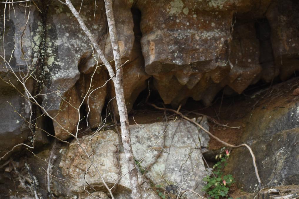
Stalagmites in a small cavern.
Ritner Swinging Bridge

Sources:

All Images Sourced from me.
topozone.com

Friday, March 13, 2020

Waco KY

Location


Among the rolling hills of Madison County lies some very unique and obscure places. Nestled on a small country road lies a small community named "Waco". Waco is slightly off of KY52, and continues onto KY 977. Despite being an unincorporated community, Waco is part of the Richmond - Berea Micropolitan Statistical Area.

Geography


A notable geographic feature is Muddy Creek, which lies roughly 3,000 feet from Waco. Muddy Creek is a small creek that begins on the Kentucky River and ends near KY 3376. The terrain around Waco is a mixture of plains and small wooded areas. Although, by looking at an overhead map, there appears to be an abnormal amount of ponds and bodies of water around the area.

History


The history of Waco is not only obscure, but it is interesting. Waco is believed to be named after Waco TX, although this is not confirmed. Some of the oldest industries in Madison county were started in Waco. This includes Waco Pottery Works. Waco is most known for it's deep history rooted in the art of pottery, as it generated a lot of revenue for the small community.

Griggs and Grinstead


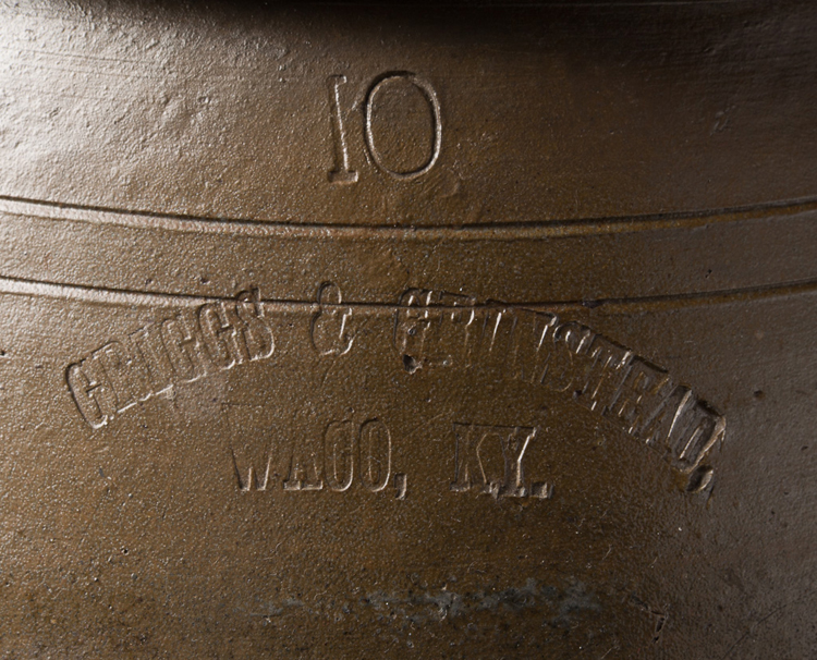
The earliest pottery maker was John Parker Grinstead, and his brother Matthew D. Grinstead, who purchased land near Waco in 1837. Not only did Grinstead produce many works of pottery, he also indulged in the stone-working business. A lot of his work is still around, but is very scarce. Grinstead tended to brand his pottery and other works with "GRIGGS AND GRINSTEAD, WACO KY."


(https://www.mesdajournal.org/2012/research-note-nineteenth-century-stoneware-makers-madison-county-kentucky/)

Philip A. Huffman

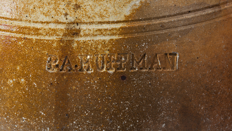
Another notable figure in Waco KY's history is Philip A. Huffman. Philip Huffman was born in Bourbon County KY, and relocated to Madison County in 1847 where he purchased property adjacent to Grinstead's land. Huffman was successful in his business endeavors and employed several well known potters. One of the hired potters was Augustus H Serren, a potter born in New York or New Jersey. Huffman was known to mark his pottery with "P.A HUFFMAN." Later on, Philip hired multiple German potters and continued his pottery career.


Valentine Baumstark

Valentine Baumstark was another notable figure in Waco's history. He arrived in 1850, and married Mary Amerine the same year. Valentine was born in Germany and was likely trained in the art of pottery before he came to America. He was employed at Huffmans. He eventually became the foreman of the business.

Eventually, when Huffman departed to Texas, Baumstark started his own business on the eastern end of Waco. His business was reportedly destroyed by John Morgan due to him being a vocal Union sympathizer. Baumstark carried on and ran the business up until his death in 1885. John Baumstark, his son, carried on the business after his passing.


Businesses and Attractions

Despite being an unincorporated community, Waco has quite a few businesses and shops. The first noticeable businesses are the Shell gas station (also named "Waco Grocery") across the intersection of 977 and 52, and the People's Trust Bank across from the Shell. 

Down into the crossroads of Waco, there is a small Bakery named "Side Porch Cafe and Bakery" and a thrift store. On down the street there is the "Waco Animal Hospital". Waco also has a volunteer Fire Department across from the "Waco Church of Nazarene."

Lastly, the post office of Waco is still in service. 

Sunday, March 1, 2020

Falls Of Rough KY

Location


The gorgeous scenery at Falls Of Rough KY is taken for granted by travelers and drivers passing by on KY 79. If you blink you might just miss it.

Falls of Rough is a small unincorporated community on the border of Grayson and Breckenridge county. Located on the rough river, and with it's rich history there is a lot to explore in this small north west KY community.

History

In the late 1700s George Wilson from North Carolina, the first documented settler of the area arrived. He built the first dam along the Rough River. Later on, Benjamin Sebastian sold it Willis Green. Willis Green's house and store are still standing today. 

Originally when the first post office opened in 1830 it was named after Green, but later on was changed to "Falls Of Rough", named after the nearby river. The dam mentioned previously was washed out in 1855, then rebuilt by Lafe Green, who received 20k from B.F Beard to rebuild the dam. 

One of the notable features of the area is the old Grist Mill standing beside the rushing waters. Green owned lots of land in the area, and this mill was one of the many profitable businesses he was running. In fact, one of Green's mills produced over 6,000 barrels of flour a day.


Photos


Sources:


Tuesday, February 25, 2020

About this Blog

This is a project dedicated to exploring the niche, and hidden beauties of Kentucky. If you're into obscure history and traveling, you're on the right blog.

I'll try to update this blog at least once a week when I get the chance. Since spring is beginning to emerge early, I thought it would be a good time to open this up.

- Enrique
Hi, welcome to Exploring Kentucky.